
Blog
Unlocking the Potential of 3D Digital Cities: A Guide to Using Drones and Emerging Technologies
As the world is rapidly urbanizing, cities are becoming more complex, and the need for smart solutions to manage them is increasing. One of the emerging technologies that can aid in the management of cities is 3D digital cities, which can provide a virtual representation of a city's infrastructure, buildings, and landscapes. Creating 3D digital cities can be a challenging task, but with the advent of drones and emerging technologies, the process has become more efficient and cost-effective. In this blog, we will discuss how to create 3D digital cities using drones and emerging technologies.
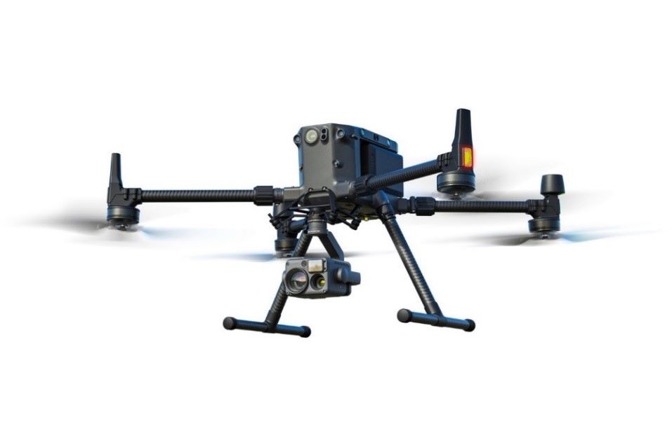
Autodesk, a leading software company, provides tools for creating 3D digital cities. FalconViz was invited perform a lecture at one of the Autodesk University events on how to create 3D digital cities using drones, We showed how to create a 3D digital city using drones. The first step is to gather data through aerial photography. Drones can be used to capture high-quality images of a city from above, which can then be used to create a 3D model of the city. The images are processed using software that stitches them together to create a high-resolution, georeferenced 3D model.
Link to the talk: https://www.autodesk.com/autodesk-university/class/How-Create-3D-Digital-Cities-Using-Drones-2019#video
Once the 3D model is created, it can be enhanced using various techniques. For example, point cloud data can be added to the model to provide additional detail. Point clouds are large sets of data points that are used to represent a physical object or space. They can be generated using LiDAR (Light Detection and Ranging) or photogrammetry techniques.
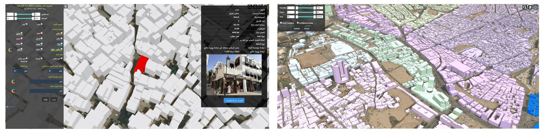
The 3D model can also be enriched using GIS (Geographic Information System) data. GIS data provides information about the location and attributes of features in a city, such as buildings, roads, and utilities. GIS data can be used to add layers of information to the 3D model, such as population density, traffic flow, or zoning regulations.
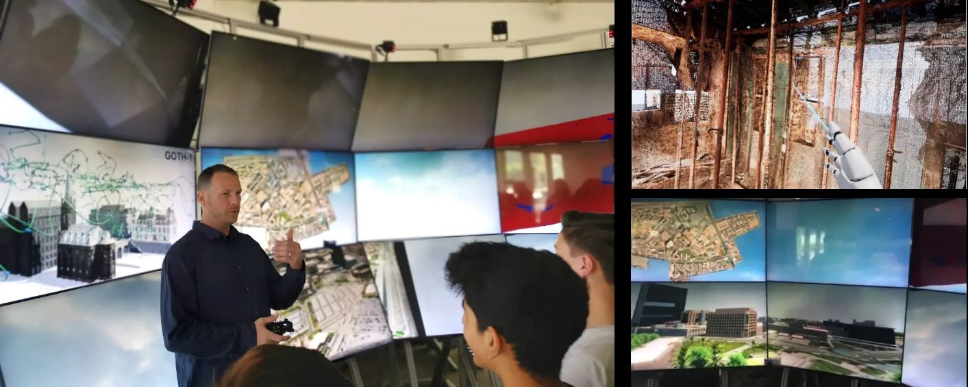
The final step is to use emerging technologies such as Virtual Reality (VR) and Augmented Reality (AR) to make the 3D digital city more accessible and interactive. VR allows users to immerse themselves in a virtual environment, while AR overlays digital information onto the real world. These technologies can be used to create virtual tours of the 3D digital city, allowing stakeholders to explore the city's features and infrastructure in a more interactive and engaging way.
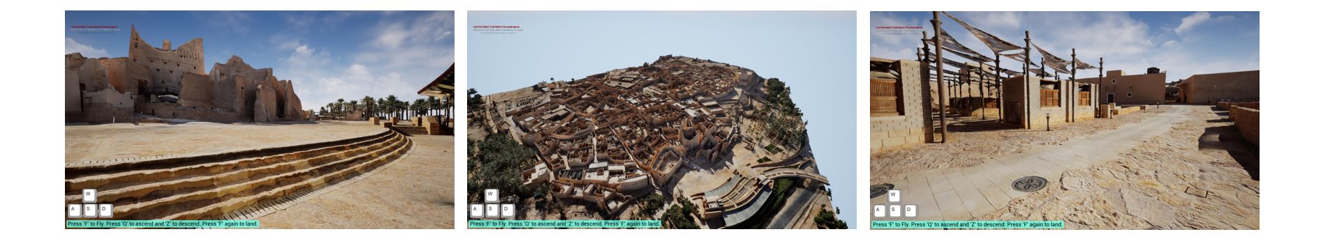
We have utilized this approach to create 3D digital cities. FalconViz has worked on several projects, including creating a 3D model of Riyadh city and creating a 3D digital twin of the Saudi Aramco compound. In collaboration with Autodesk, FalconViz utilized drones to capture aerial imagery, which was then processed using Autodesk software to create a high-resolution 3D model. FalconViz also used LiDAR data to add additional detail to the model. The use of drones and emerging technologies has several benefits when creating 3D digital cities. Firstly, it is a cost-effective way of gathering data. Drones can capture high-quality imagery quickly and efficiently, reducing the need for costly manual data collection methods.
Secondly, it is a more accurate way of gathering data. Drones can capture data from difficult-to-reach locations, such as the roofs of buildings, which would be challenging to access using traditional methods. Lastly, it is a more scalable solution. The use of drones can cover large areas quickly, enabling the creation of 3D digital cities for entire cities. All of these technologies help us create metaverse applications which completely integrate digital cities and allow us to explore infinite possibilities and variables all through one single interface. FalconViz were delighted to be mentioned in a Strategic Gears report which studied the implementation of Metaverse applications in Saudi Arabia, linked below:
https://strategicgears.com/ar/images/report-ar/metaverse_development_in_saudi_arabia_ar.pdf
In conclusion, the creation of 3D digital cities using drones and emerging technologies is a cost-effective, accurate, and scalable solution. With the use of drones, the process of gathering data has become more efficient, and with the use of emerging technologies such as VR and AR, the 3D digital city can be made more accessible and interactive.