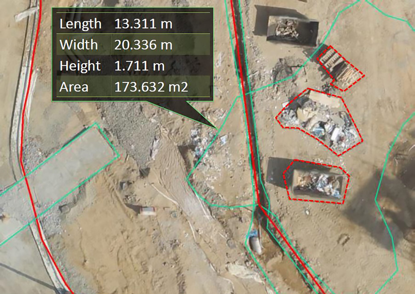
Cities are constantly evolving and facing new challenges with their ever-growing populations. By using FalconViz drones, municipalities and government entities can better manage their projects and monitor their lands. Problems such as land abuse can be more easily identified and tackled more effectively, development of new areas or re-development of existing ones can be better managed through our services.
Deliverables
- 2D as-built CAD Drawings
- 3D as-built CAD Drawings
- Contour Line
- Digital Elevation Model (DEM)
- Digital Terrain Model (DTM)
- 3D HD Model
- 3D Walk Through
- 3D Fly Through
- True Orthographic Photography
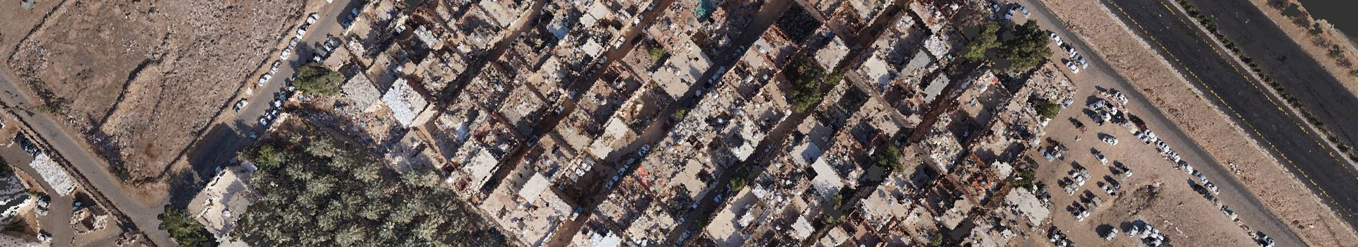
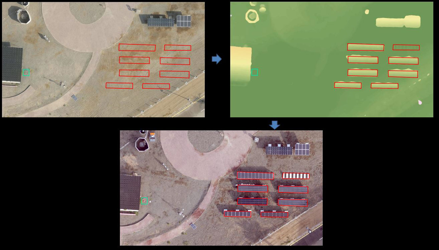
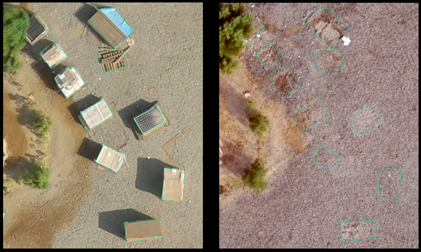
- HD Areal Photography
- HD Video shooting
Clients

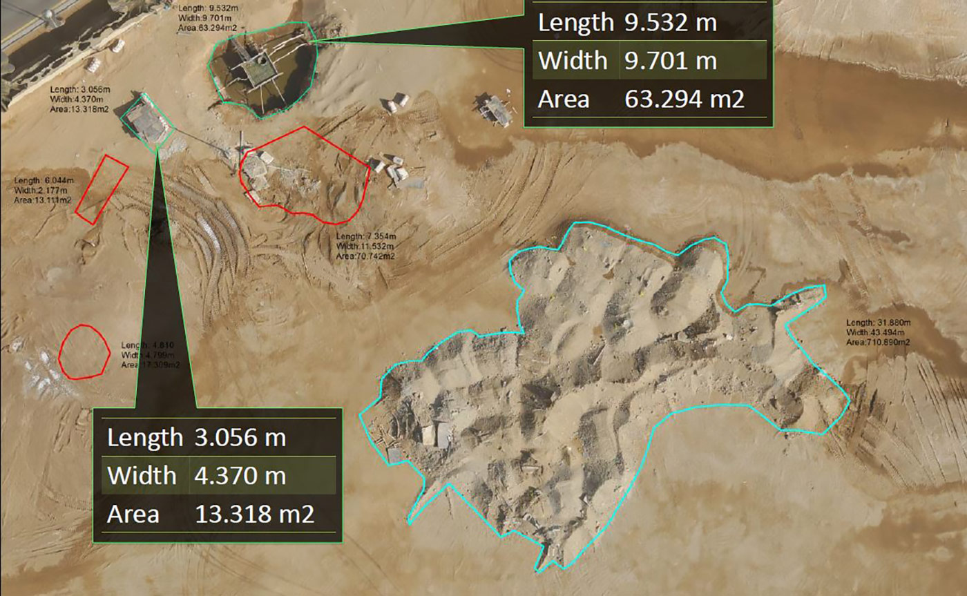
- 3D as-built drawings
(up to 0.5 cm accuracy) - 500,000 m² per day
- Volume assessment for stock
- Low cost areal monitoring / imaging
- Inexpensive monthly charge
GET A QUOTE
Samples
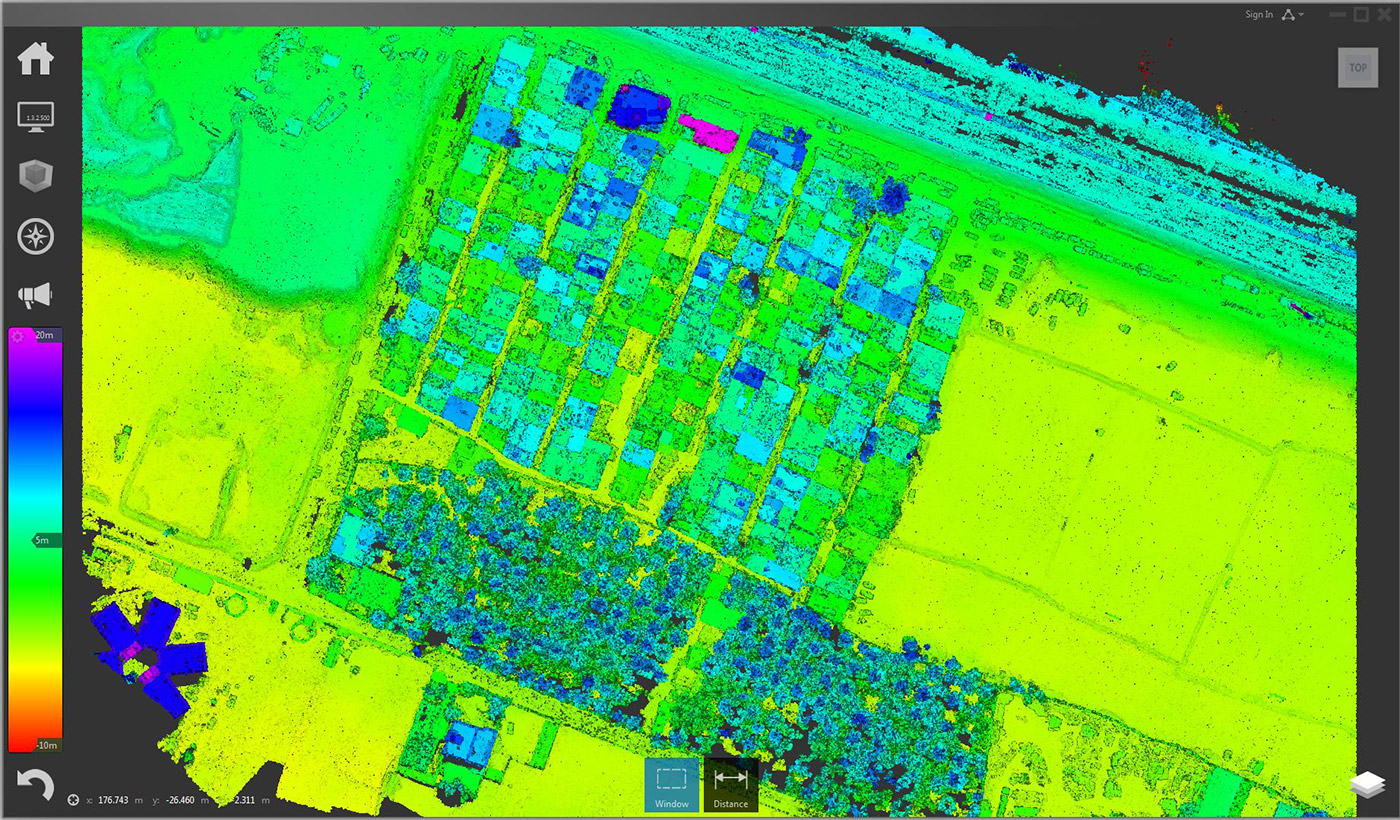
Elevation ramp color
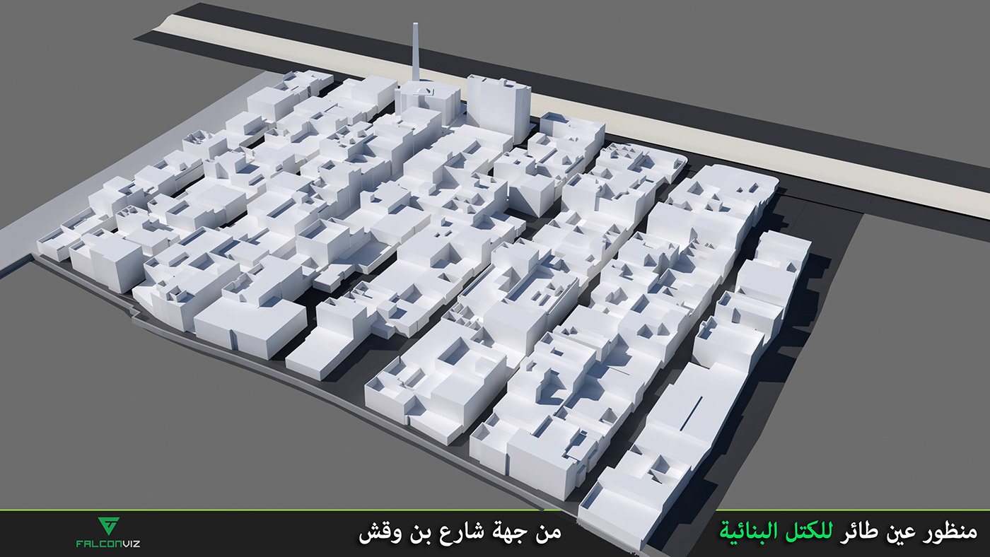
Massing perspective
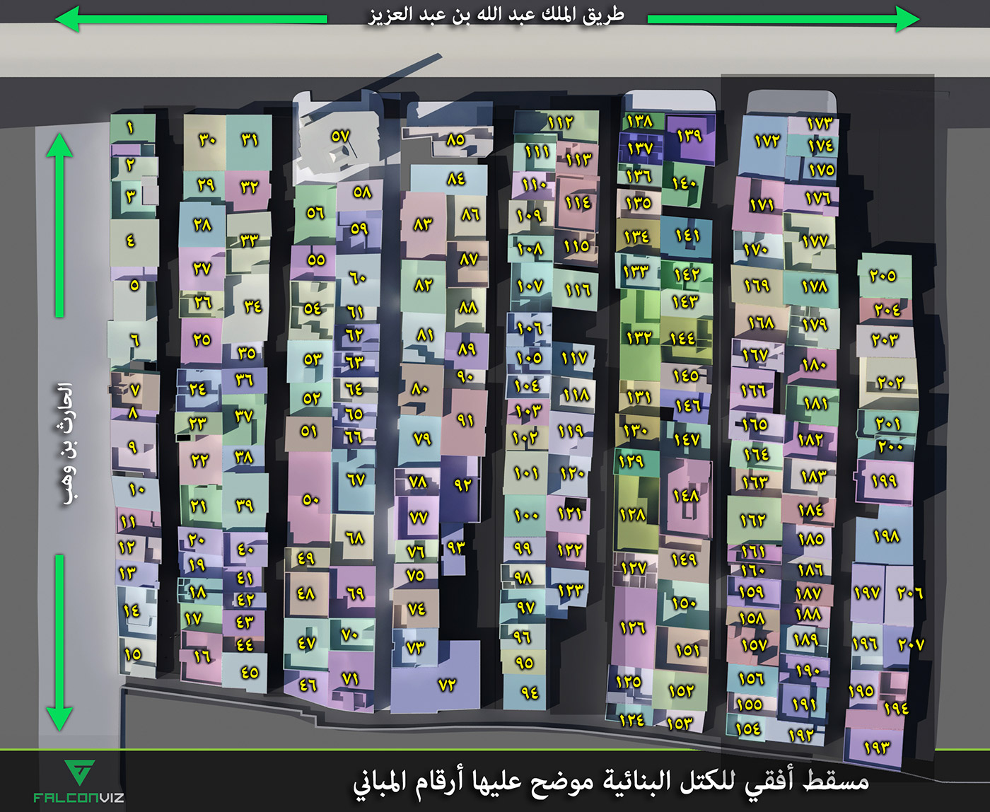
Buildings plan labeled
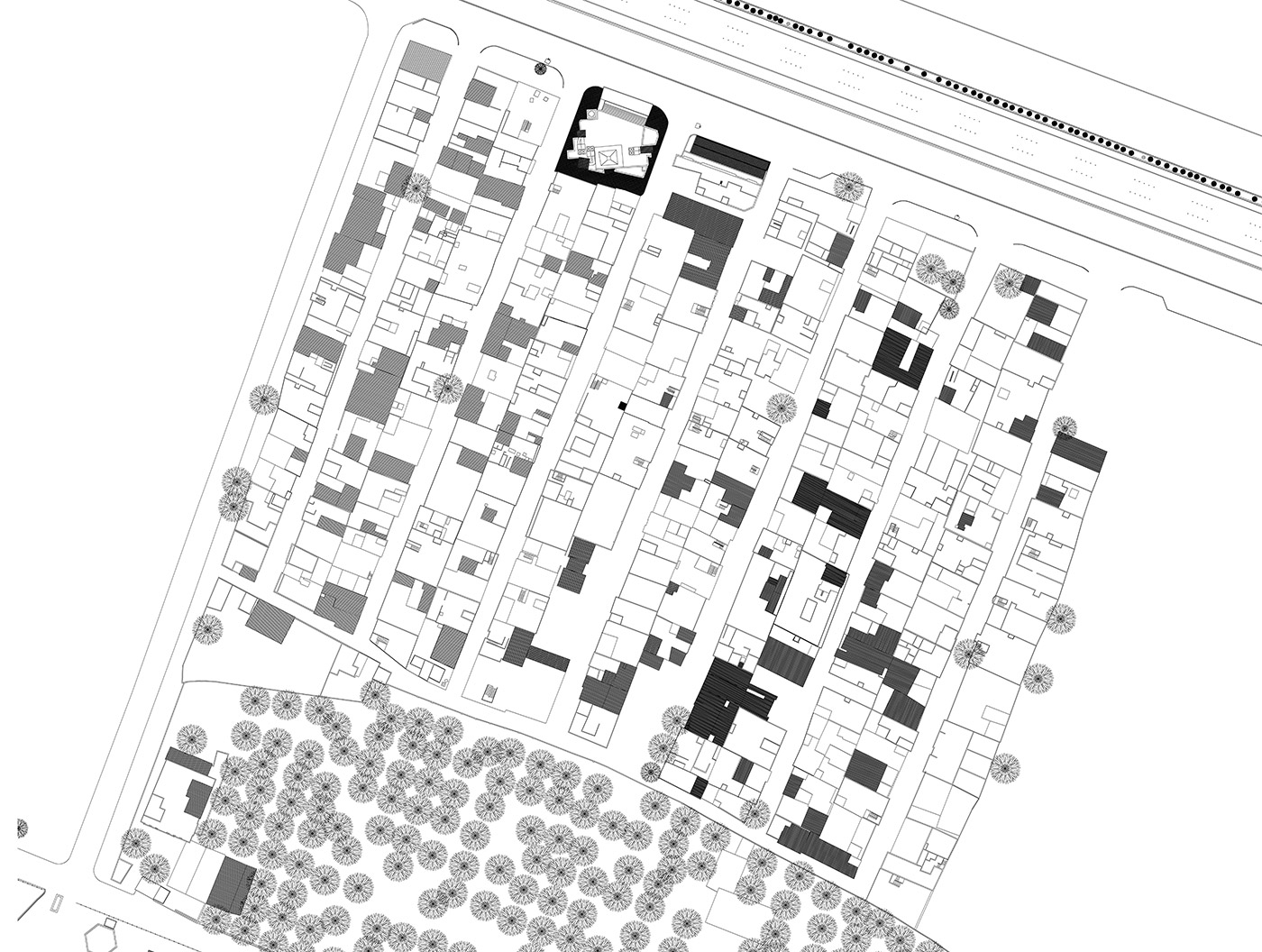
CAD survey
KEEP IN TOUCH