
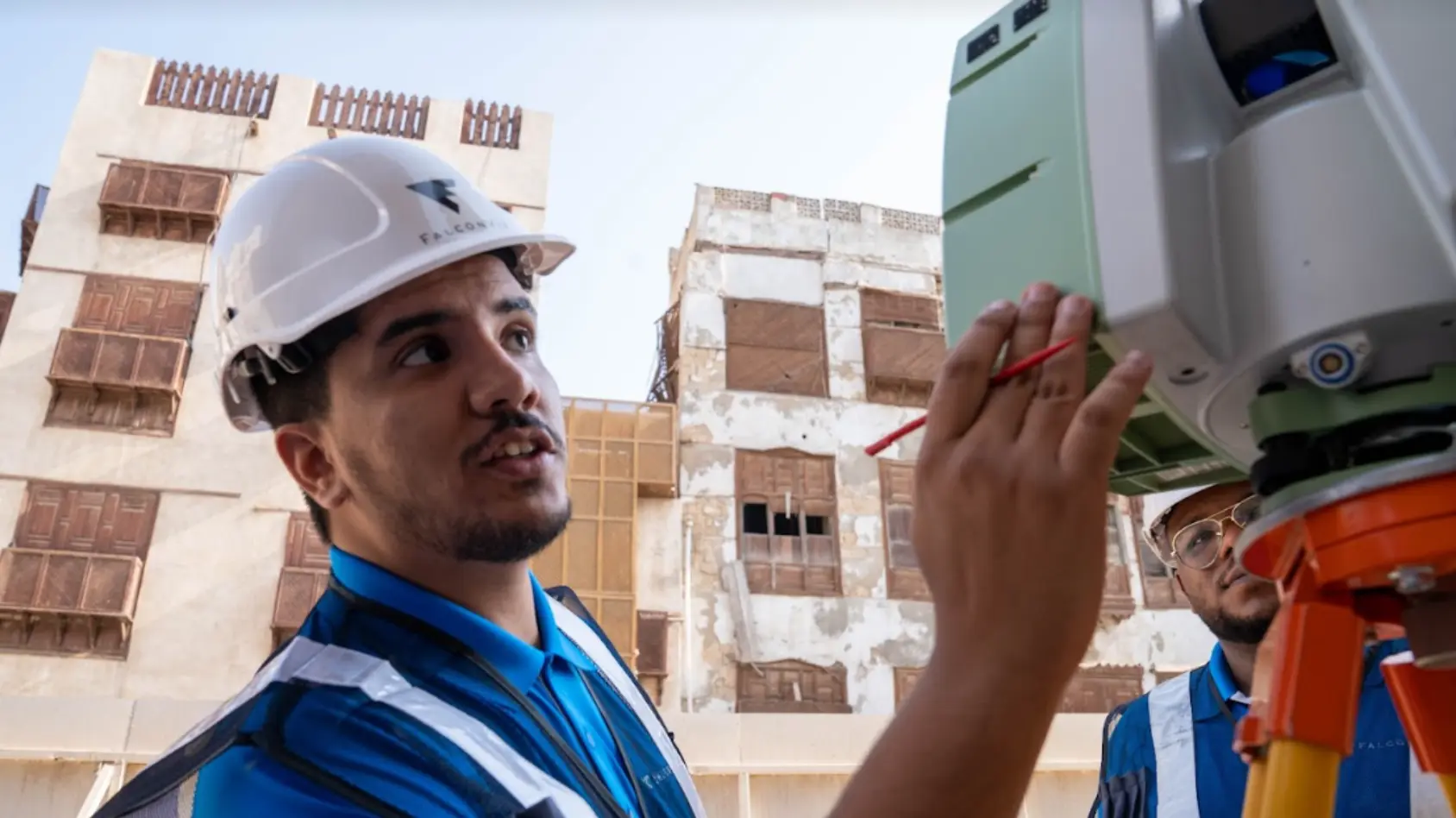
3D Terrestrial Laser Scanning
3D Terrestrial Laser Scanning
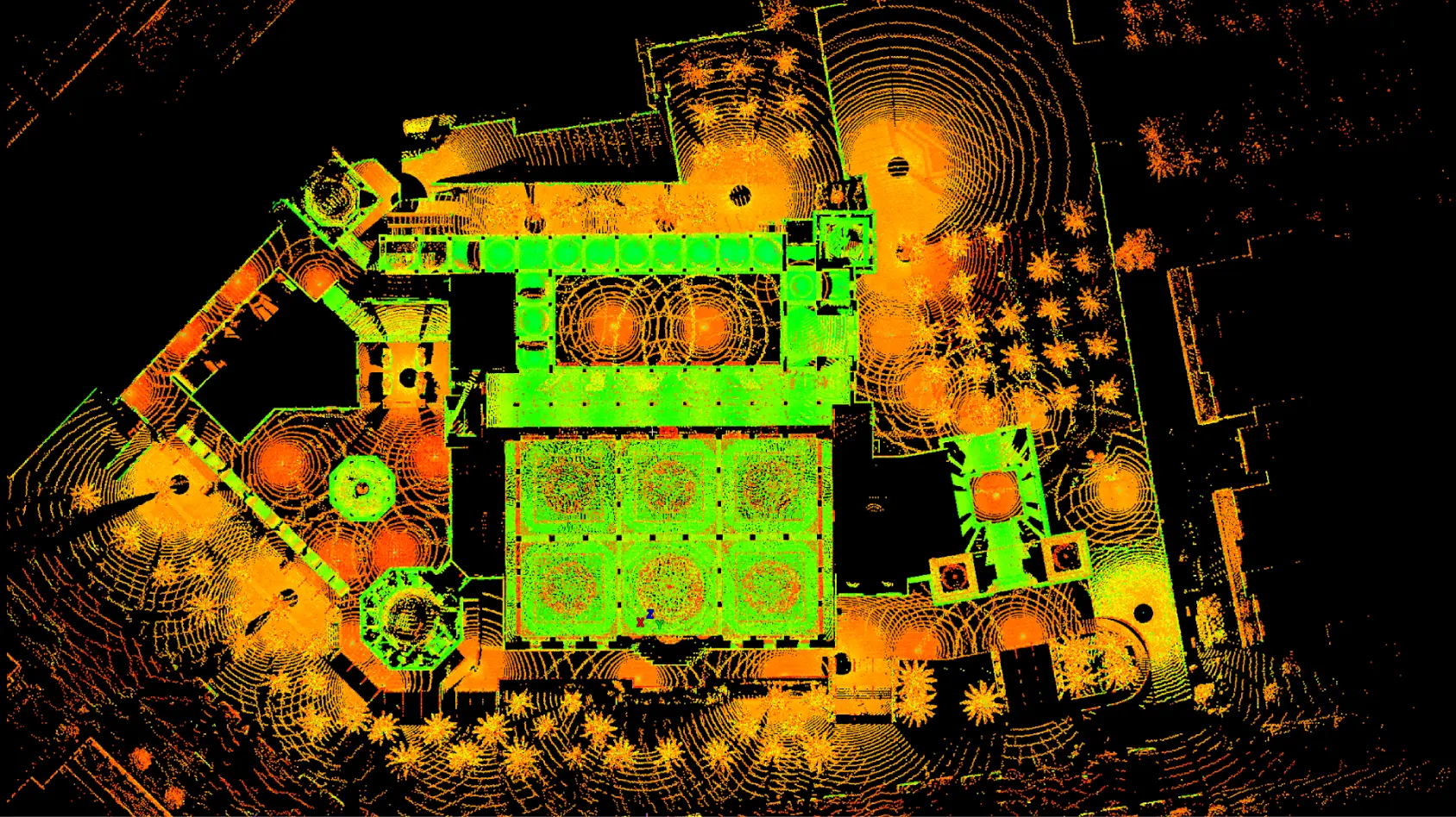
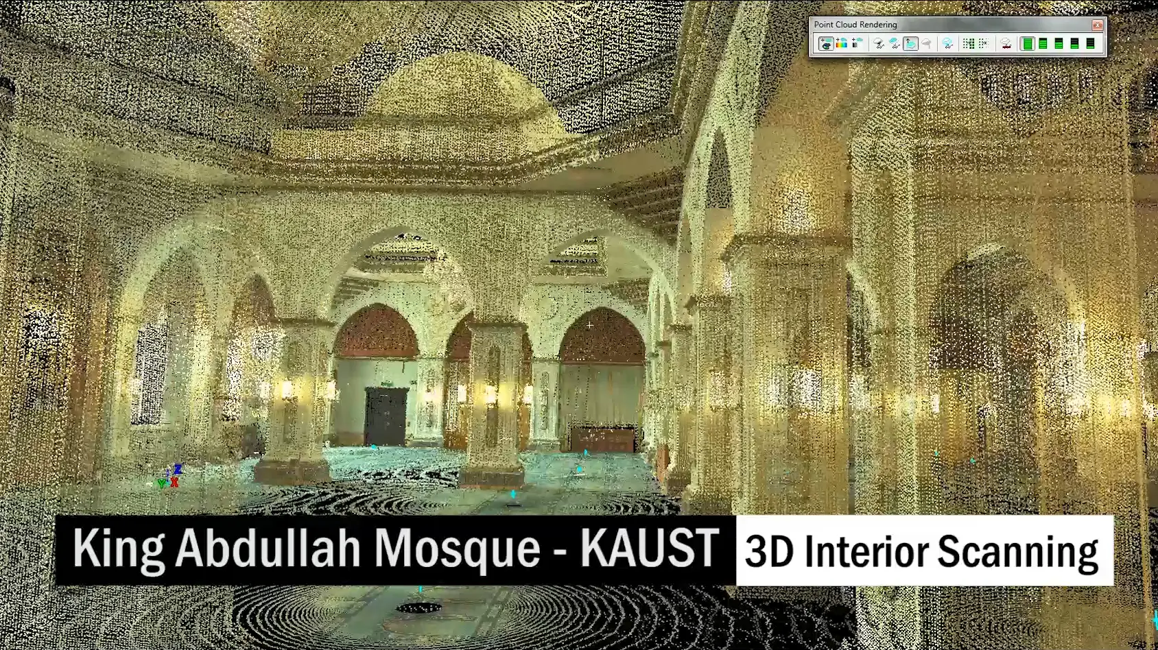
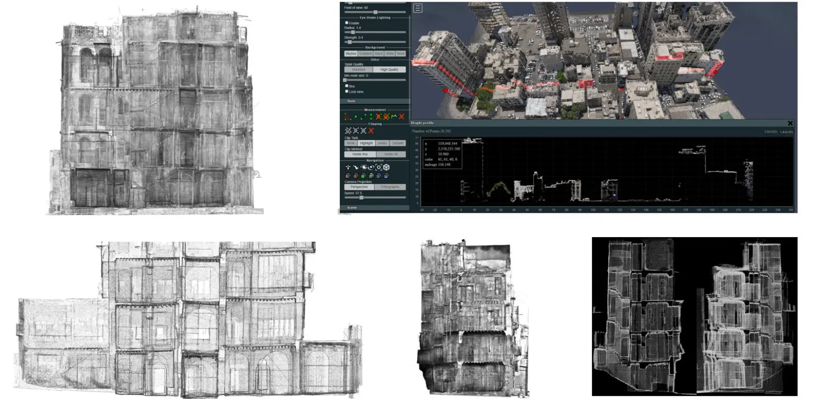
3D Laser Scanning is essentially the rapid capture of three-dimensional (3D) information
reflected from an object or surface onto a light sensor. Once the point cloud data is
processed, traditional deliverables such as 2D plans, elevations, and sections can be
readily extracted, or used for fly-throughs and contextual purposes.
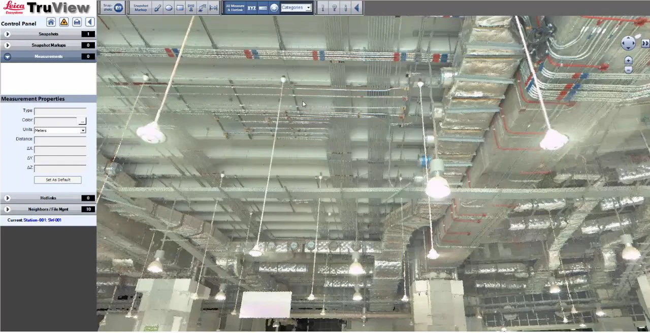
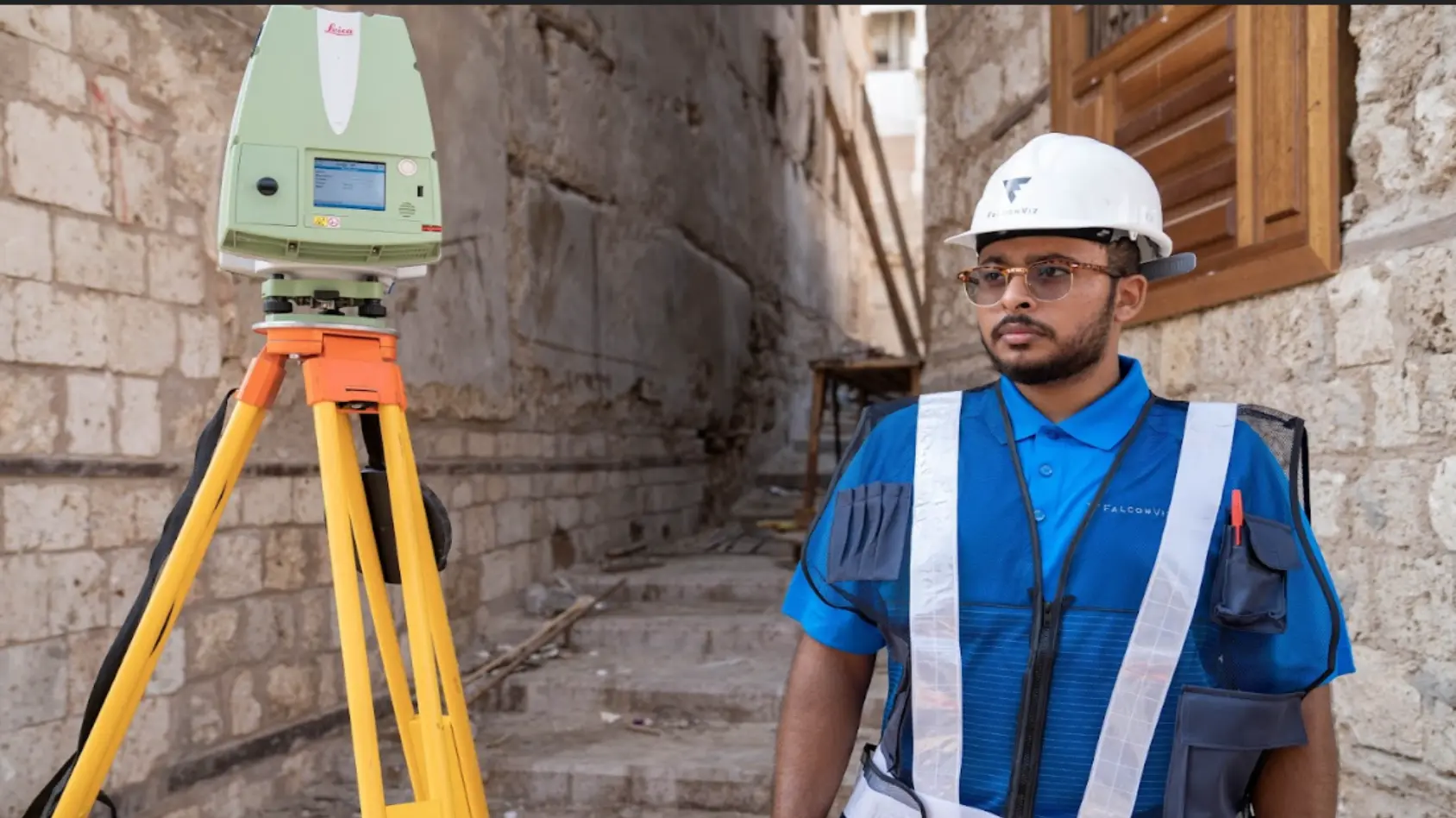
After the
scans are registered, a three-dimensional database is established that can be used
throughout the building’s lifecycle, or to aid in reconstruction should damage occur
in the future. Additionally, remarkably sharp and descriptive photographic data is
fused with the point cloud to produce dynamic panoramas. In most cases, measurements
can be taken from these images and have annotations added to them.
Construction Monitoring
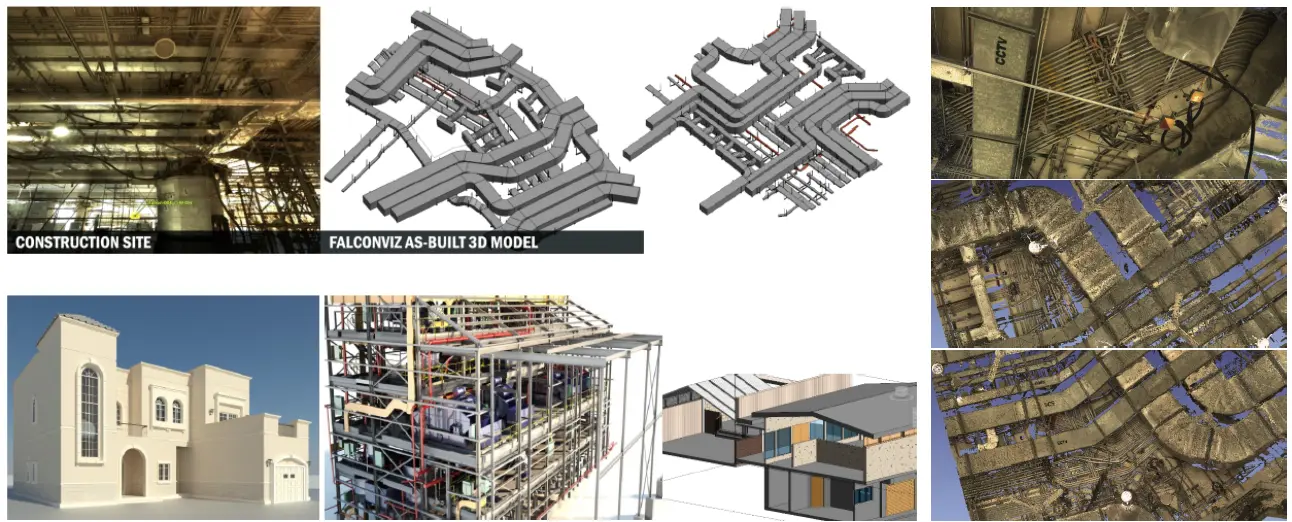
- As-built Modeling (Scan To CAD/BIM)
- Site Awareness and Visualization
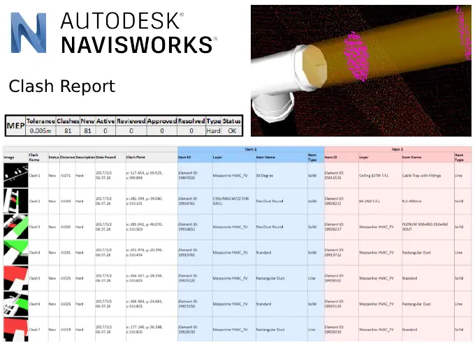
- Clash Detection
- Verification
- Digital Twin
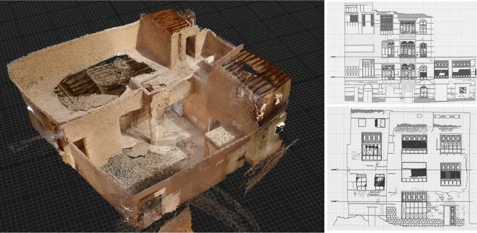
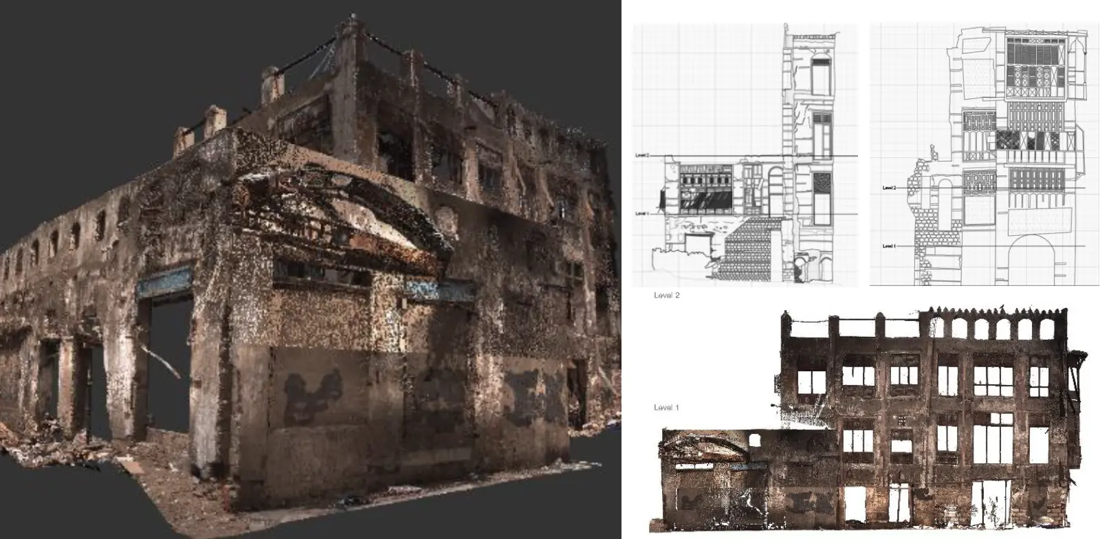
Cultural Heritage Documentation
- Full 3D Documentation of Historical Buildings
- Architecture and Structural Integrity Assessment
- As-Built CAD Drawings of Facades and Floor Plans
Facility Management
- Asset Inspection
- Asset Inventory
- Spare Parts Replicas
- Digital Twin
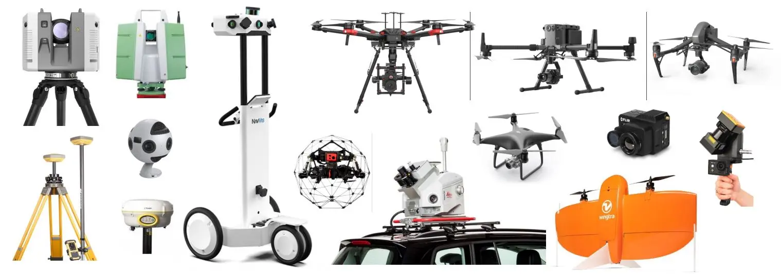
How Do We Do It?

Latest Laser Scanners on the Market
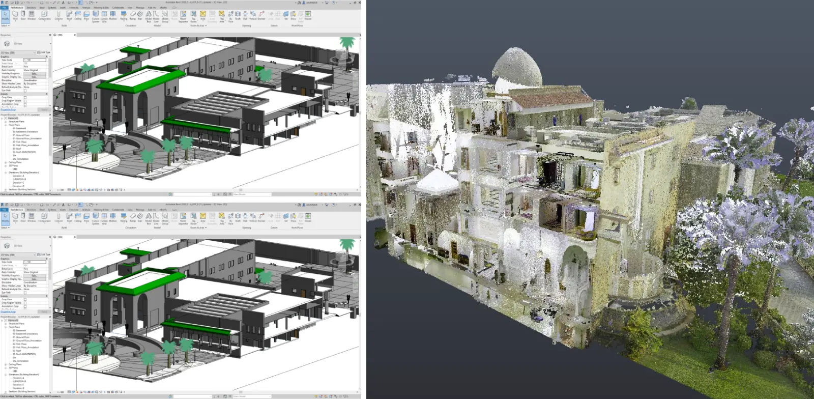
Products and Deliverables
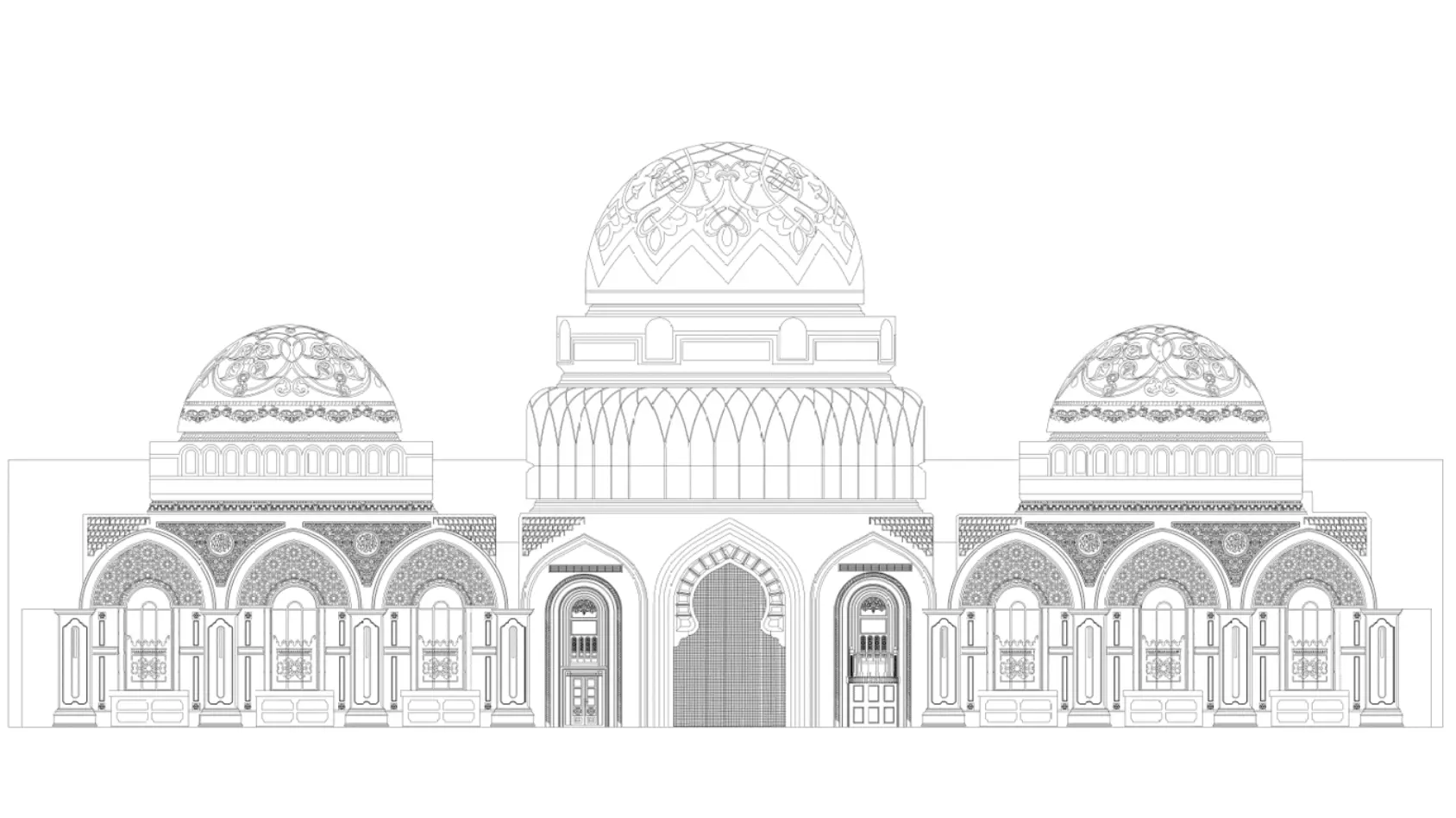
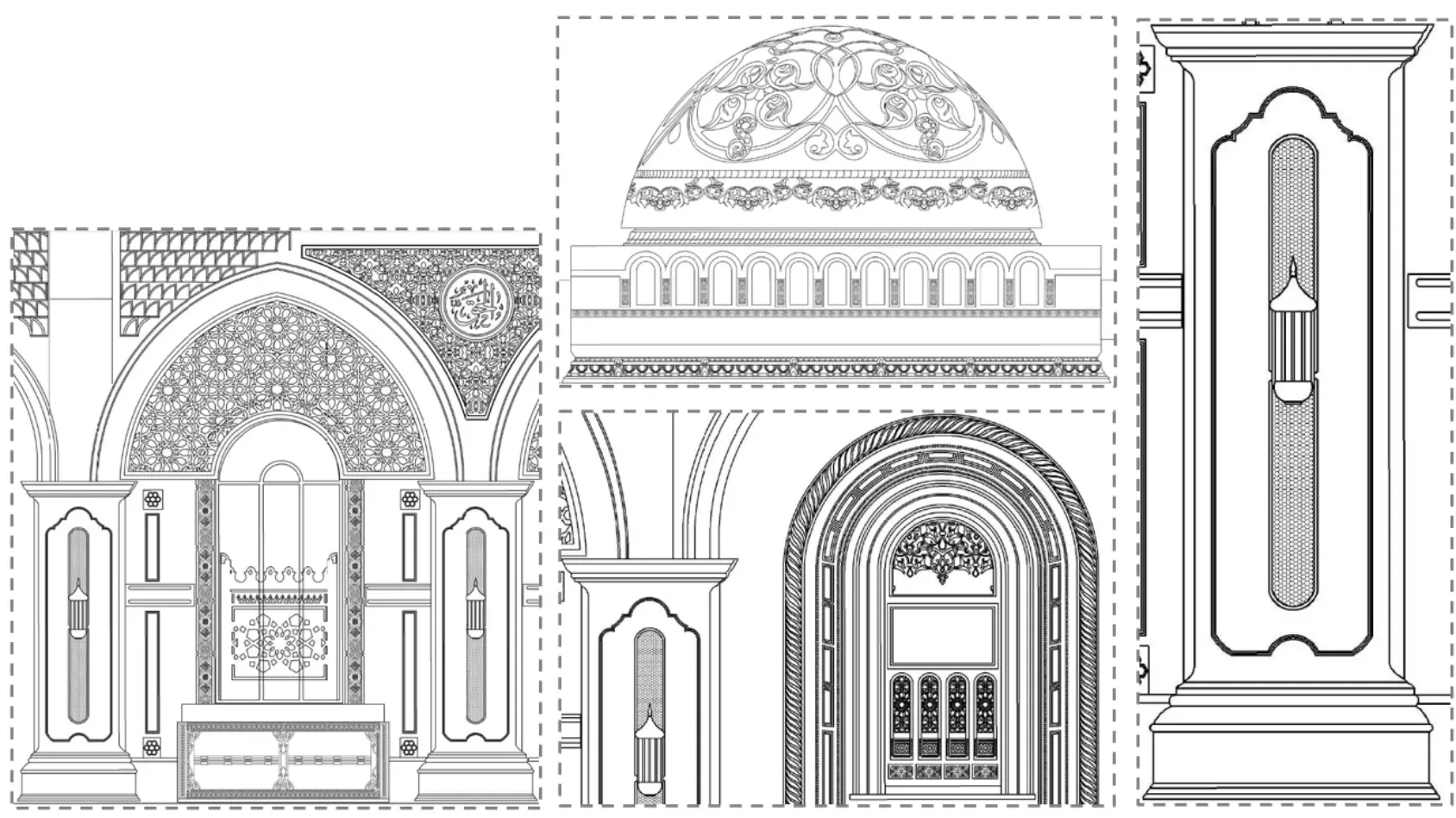
2D Products
- Line work extracted as a standard CAD DXF or DWG file
- Topographical and roof plans
- Building and structure elevations
- Cross-sectional and longitudinal sections
3D Products
- Rendered 3D models (AutoCAD, 3DStudio MAX or Revit)
- Animated visualisations (AVI or MP4)
- 3D Point Cloud
- BIM in Revit or IFC for import into other BIM
- GIS Application
Trusted by the Following Clients

Contact us
Get a Quote
We provide an up-front quotation on your project so you’ll know the total cost without any surprises and be in control of the cost
Get Quote