
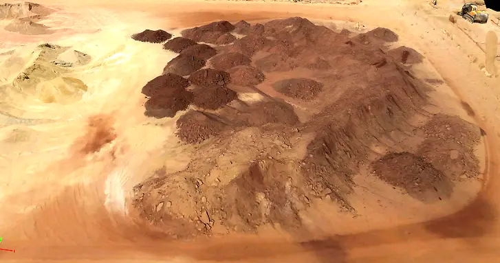
Volumetric Assessment
Volumetric Assessment
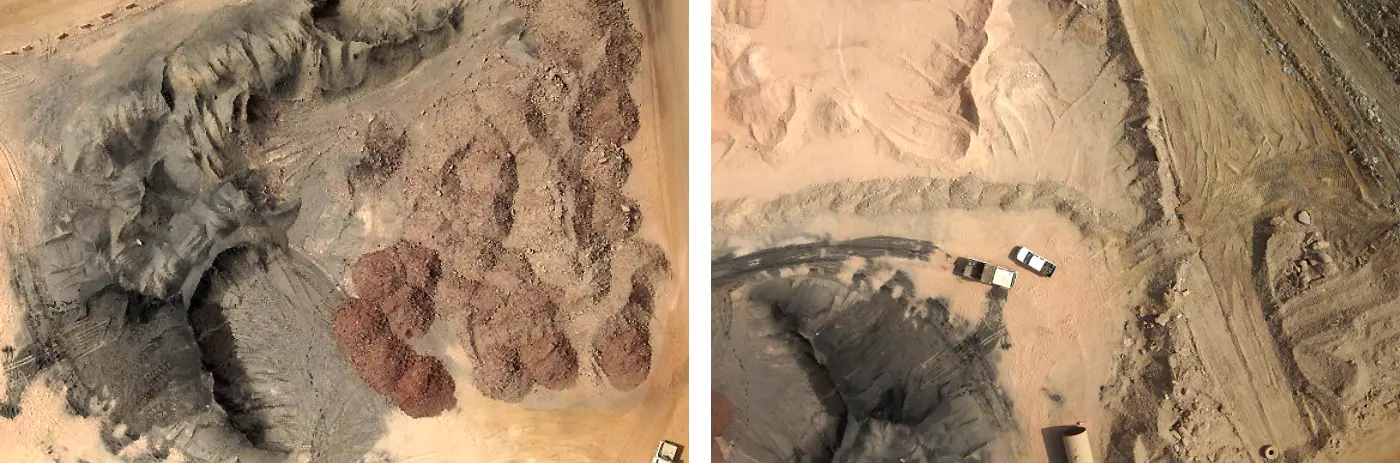
FalconViz provides precision volumetric measurement mapping and modeling of large and complex mine sites, quarries, landfills, agricultural sites, and development sites, even in remote areas. Our specialized PPK mapping drones, combined with precise RTK ground control, can capture 1.5-3cm precision data even across large areas.
Accuracy
Drones provide highly accurate volumetric measurementsmeasurements beyond the accuracy of traditional methods. When appropriately deployed with the right set of sensors, drones have provided exceptional accuracy up to a few centimeters.
Efficiency
Drones collect data in a highly efficient manner permitting measurements to be taken at a much faster rate than compared to manual labour.
Accountability
Drones offer higher accountability and can prevent illegal mining activities through tighter inventory management and consistent monitoring.
Accessibility
Drones fly over hazardous and hard to reach areas and collect imagery without risking the lives of personnel.
Deliverables
High-Definition Orthophoto
Aerial map photos provide up-to-date ortho-rectified images of the whole area. A resolution of 2.0cm/pixel is achieved with 10X the resolution of satellite imagery. All aerial images are pre-sorted, color balanced, and sharpened to produce dynamic eye-catching images. The orthophoto is sufficiently accurate to allow measurements to be taken from the image.
Digital Surface Model (DSM)
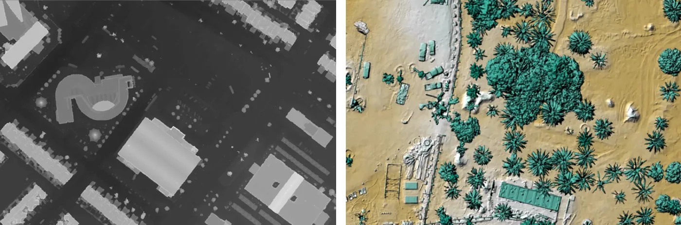
DSM's measure the height values of the first surface on the ground. This includes terrain features, buildings, vegetation, power lines, etc. DSM's provide a topographic model of the earth's surface. DSM's can be used to create 3D fly-throughs, support location-based systems, and augmented simulated environments.
Digital Terrain Model (DTM)
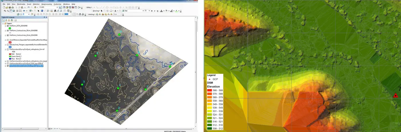
Our Digital Terrain Model (DTM) is processed at maximum resolution and accuracy. We can export different surface resolutions up to 1m cells. The data is compatible with:
- ESRI-ArcGIS
- Cesium
- AutoCAD/MicroStation
2D CAD Master Plan
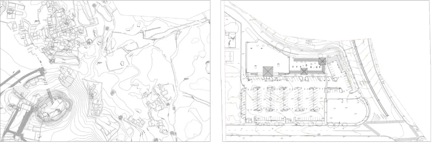
Our architects and CAD draftsmen are able to produce all line-work necessary to achieve highly
accurate 2D
master plan drawings (digital Civil AutoCAD plot) including contours, spot elevations,
boundaries,
and GCP mark positions.
Features such as light poles, trees, existing buildings
[if any],
manholes, and any exposed elements that can be clearly seen are traced.
Contour Map
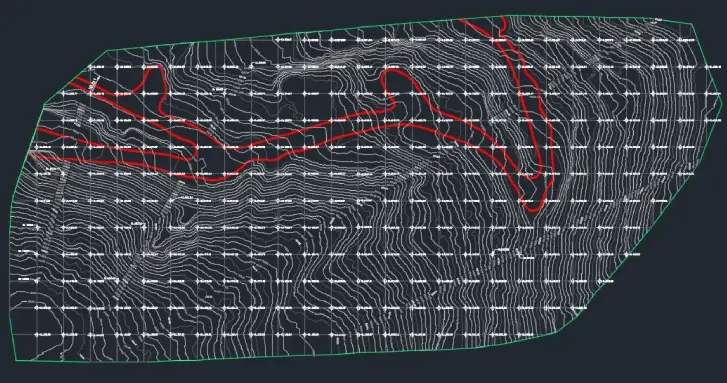
Contour lines are created from an accurate DTM and beautifully show the topographic features such as hills, depressions, and slopes. Combined with orthophoto or DSM/DTM, contour lines are a great way to visualize the topology while analysis and other visualizations can be derived from the underlying DTM data. Mapping software allows the data to be interactively explored and analyzed.
3D Mesh Model
We provide a very highly detailed 3D photorealistic mesh. The 3D mesh is geo-referenced with very high accuracy. The final delivery format is a georeferenced .obj file with textures and a .mtl file. The mesh will be generated from Pix4D software.
3D Point Cloud
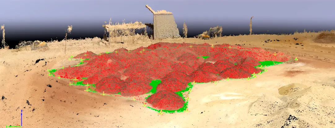
We provide processed high-density true colored point-clouds in LAS format.
Surveying Report
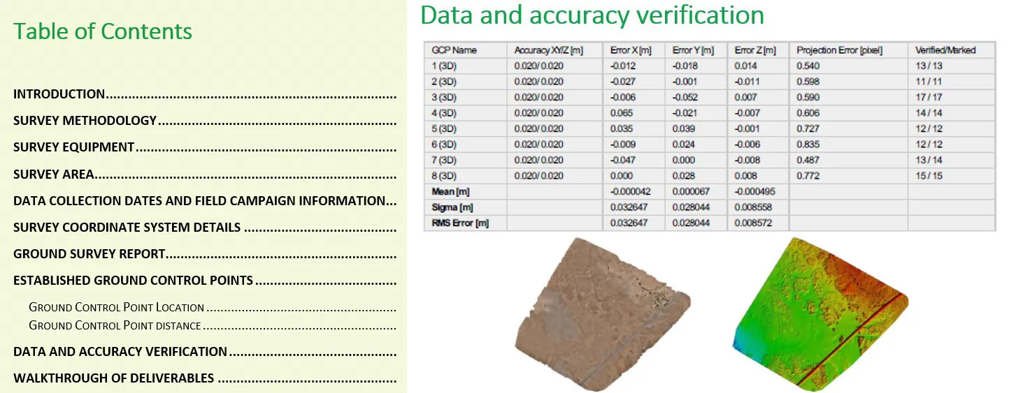
We generate a complete detailed Aerial Survey Report and Land Survey Report. The reports detail
all steps and methodologies including quality assurance and control used to generate the
deliverables.
The report includes the specifications of the equipment used, software(s) details,
methods of collection, accuracy of the data, processing methods, collection dates, definition of
the coordinate system and coordinate conversion complete information, use of information of
previous maps, etc.
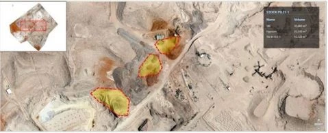
Change Detection Report
We use state-of-the-art change detection and object extraction technology to issue a quarterly change detection report.
Changes are tracked by analyzing a time series of high-resolution earth observation (EO) images. In the pre-processing stage, the images are radiometrically calibrated to allow meaningful inter-comparison, followed by a terrain correction to minimize positional errors and geometric distortions.
StockViz Platform
We designed and developed a mining-specific platform to visualize geographic and earth observations data (UAS and satellite images, point clouds, contour maps, videos and reports). The platform is designed to visualize the change detection of all the stockpile volumetric measurements and to manage the relationship between national regulators and the investors who have mining licenses in the country.
Talk to our Experts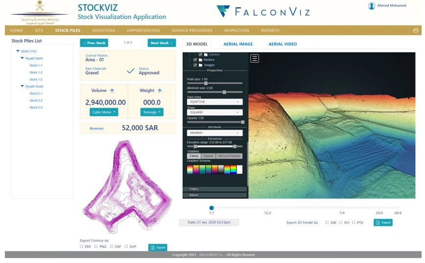
Trusted by the Following Clients

Contact us
Get a Quote
We provide an up-front quotation on your project so you’ll know the total cost without any surprises and be in control of the cost
Get Quote