Inspection
Flare Stacks
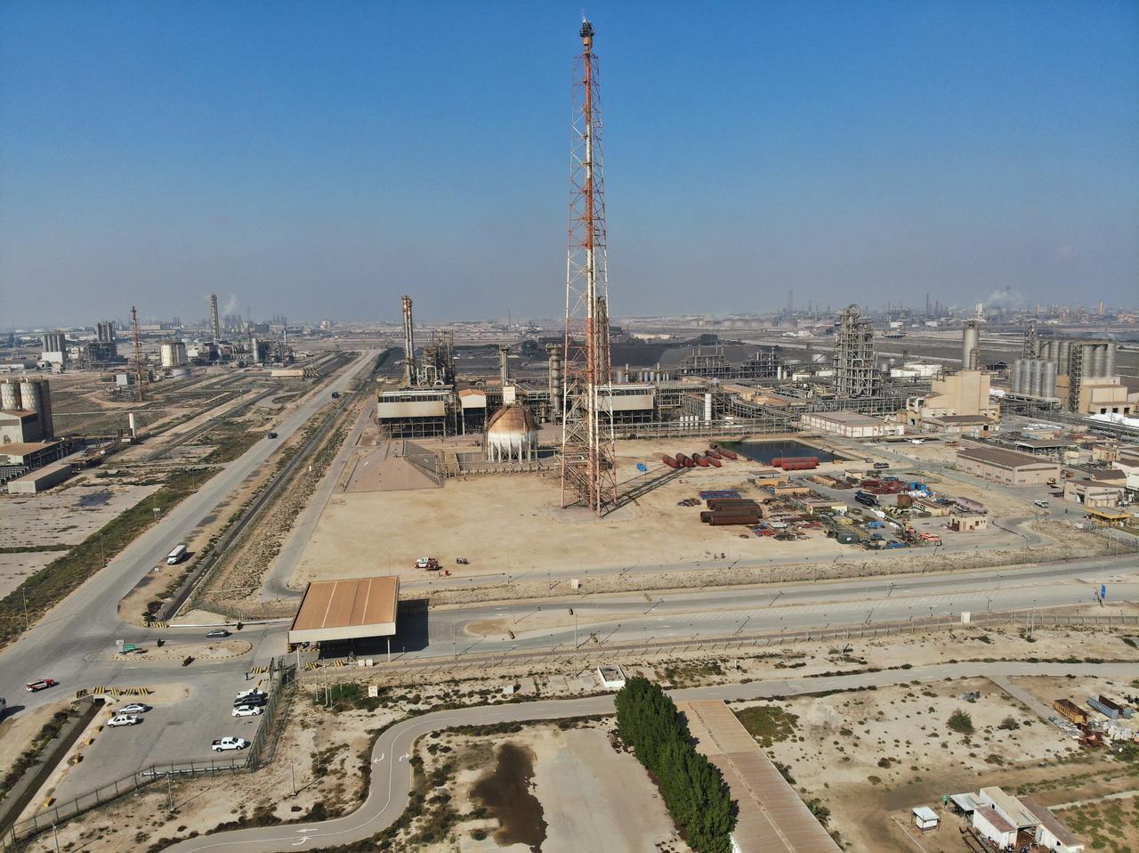
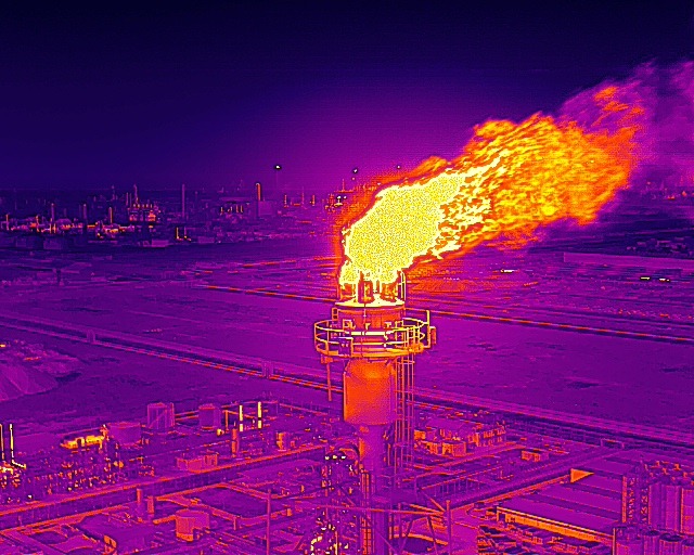
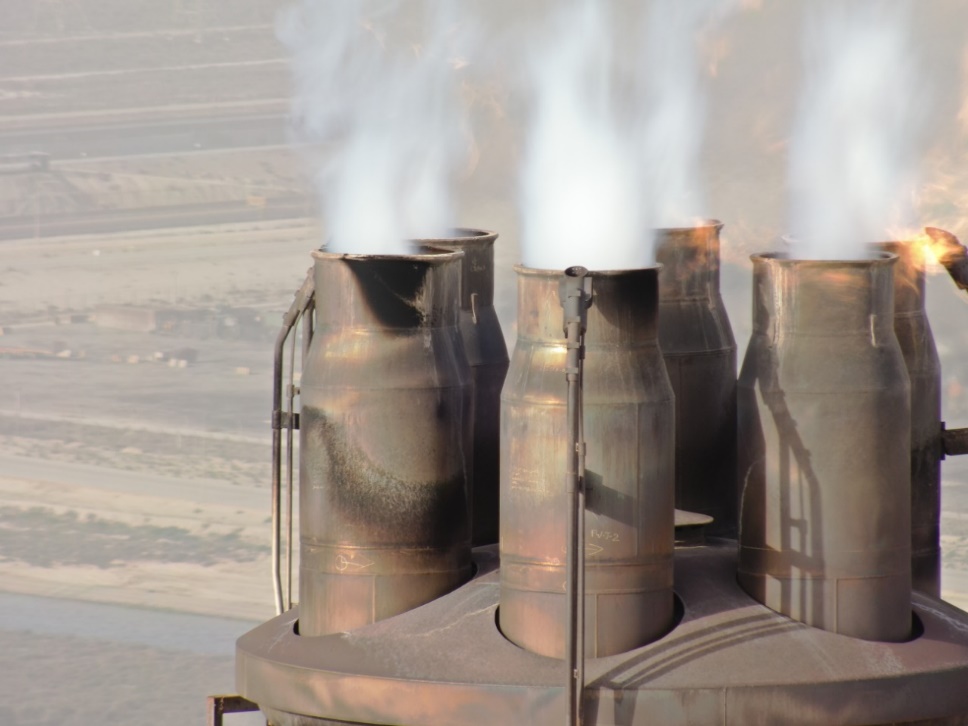
FalconViz offers unprecedented visual access to hard-to-reach areas during flare stack inspections. Our specialists in UAV aerial photography use high-grade professional cameras to ensure that the customer can complete a comprehensive inspection of their asset. Our pilots are specialized in performing live flare stack inspections, and we are able to provide valuable insights into the condition, function, and integrity of a gas-flare system through UAV videography. The processing plant and flare system can remain fully operational during the inspection, thereby helping to prevent major events, such as scheduled shutdowns or unusual flaring.
- Full-360 degree perspective of the asset
- High-resolution images
- Thermal images
- Inspection reports
- Onshore and offshore capability
Confined Spaces
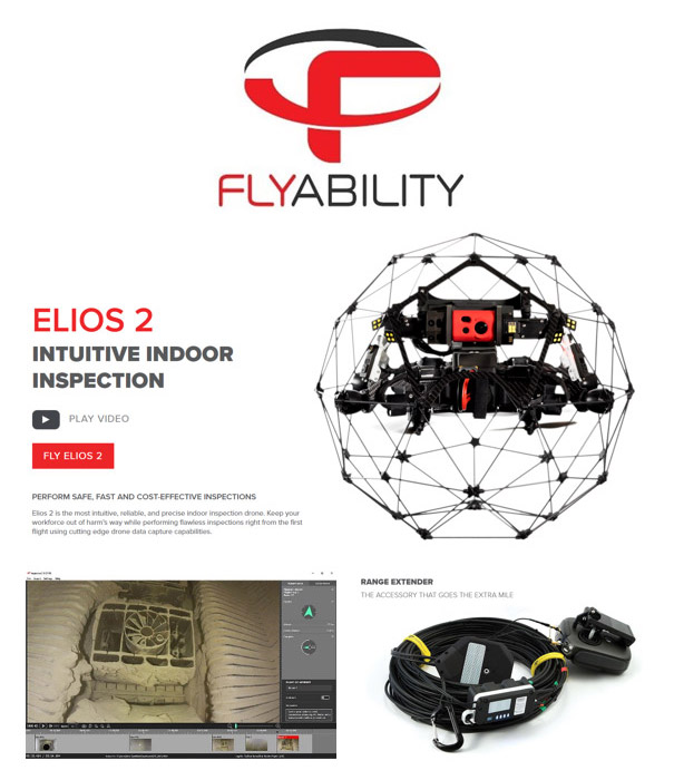
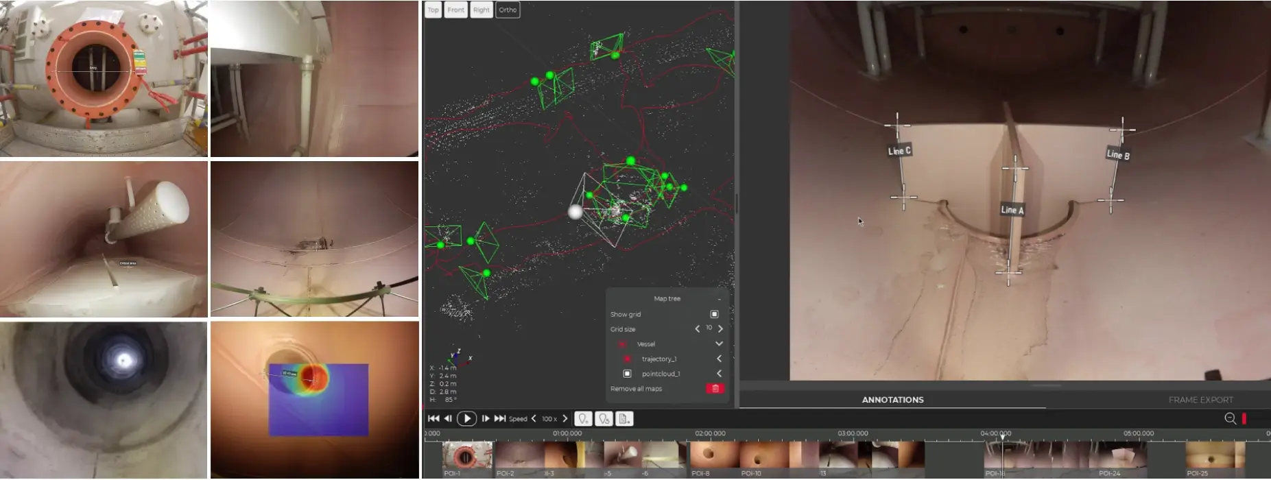
Quickly turn asset data into digital insights, with Elios 3 - the first mapping and inspection indoor drone, offering an unmatched combination of intelligence, versatility, and stability.
We use Flyability's Elios drone, the most intuitive, reliable, and precise indoor
inspection drone on the market. We keep your workforce out of harm’s way while performing flawless
inspections right from the first flight with our cutting-edge drone data capture
capabilities.
We use the Elios drone to inspect confined spaces in the following industries:
- Chemical
- Infrastructure and utilities
- Power generation
- Mining
- Oil & Gas
- Maritime
- Public Safety
- Sewer
- Food and Beverage
Benifits:
- Reduce the Need for Confined Space Entry
- Reduce the Need for Rope Access
- Reduce the Need for Scaffolding Work
UT Inspection
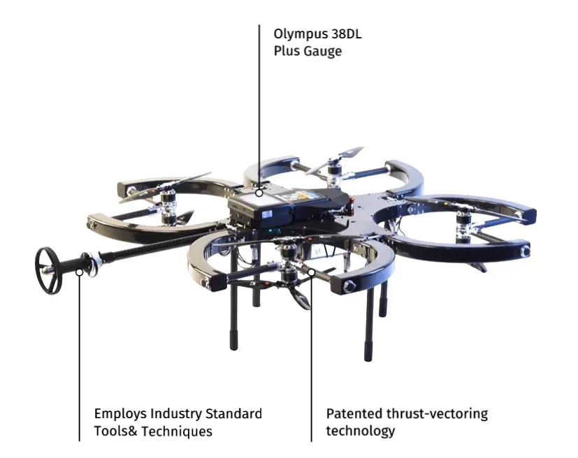
In collaboration with our partners, we provide an innovative solution that . Combines their drone with a UT gauge to measure the thickness of metal walls.
The Drone for Ultrasonic Testing
The most stable and powerful industrial drone for non-destructive testing. Perform ultrasonic thickness inspections while simultaneously conducting both Close Visual Inspection (CVI) and General Visual Inspection (GVI).
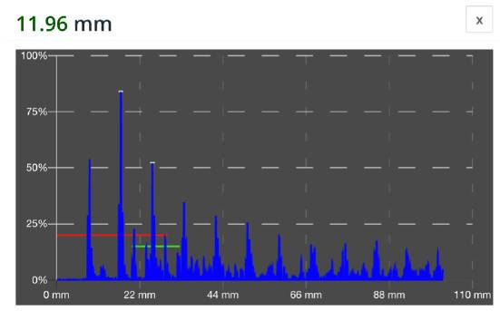
The drone reaches beyond visual inspections with the ability to take precise ultrasonic readings at height using the ultrasonic thickness gauge. Once the inspection surface has been reached, it is automatically dispensed to ensure secure contact. View your readings comfortably from the ground in real-time.
Cloud Data Platform
- Fully cloud-based inspection platform for industrial inspection data
- Supports inspection standards like API653 and API510
- 2D and 3D visualization of equipment (“Digital Twin”)
- Positioning and annotation of inspection data in 2D and 3D
- Support for video, photo, thermal, and measurement data
- Decomposition of objects and assessments per element
- Integration with various drone platforms
- Role-based user access (asset owner, inspector, UAV operator)
- Can be integrated with 3rd party software solutions via API
Confined UT inspections
 VT and UT Drone Inspection, Coating Thickness Drone
  UT Roof Inspections, Indoor and Outdoor
 Roof Support Structure Assessment, IPE / UNP / T Rafters
 Outdoor UR Inspection
 Non-Entry VT & UT Inspections
 UT Floor Inspection
Telecom Towers
FalconViz provides raw and processed data of scanned telecom towers. Through the use of drones, we provide geotagged, raw RGB images, with the location
coordinates saved in their meta data.
Additionally, we provide
processed point
cloud and 3D meshes of the scanned tower. Check out some samples of our data below.
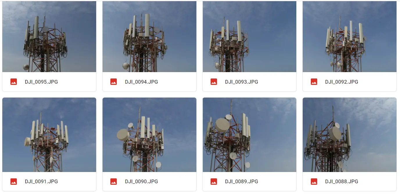 Sample raw images of scanned telecom towers captured via drone
We generate the following reports:
- 3D As-Built Tower Analysis Report
- Rust Analysis Report
- Missing Bolt Anomalies Report
- Anomalies Report
- Empty Antenna Mounts Report
- Indicative EME Report
Additionally, we provide the following features through our web application:
- • 3D Mesh Model & Photo Navigation
- • Orthomosaic View in 2D
- • Panorama x2
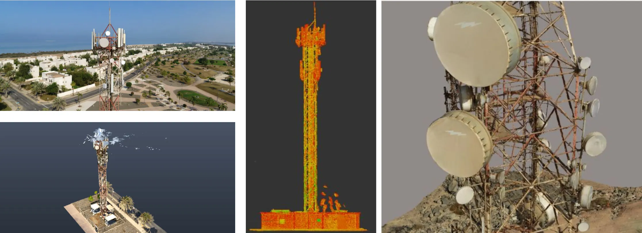
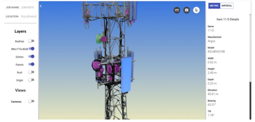 Tower assets inventory and visualization
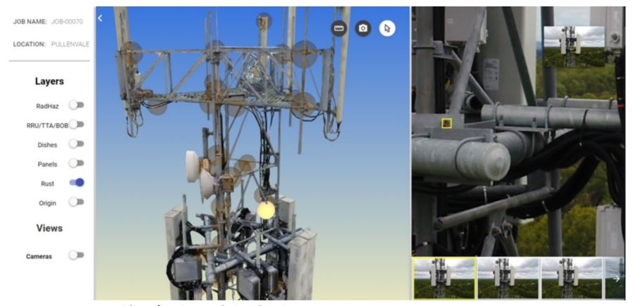 Rust identification and visualization
Solar
Thermal Inspection
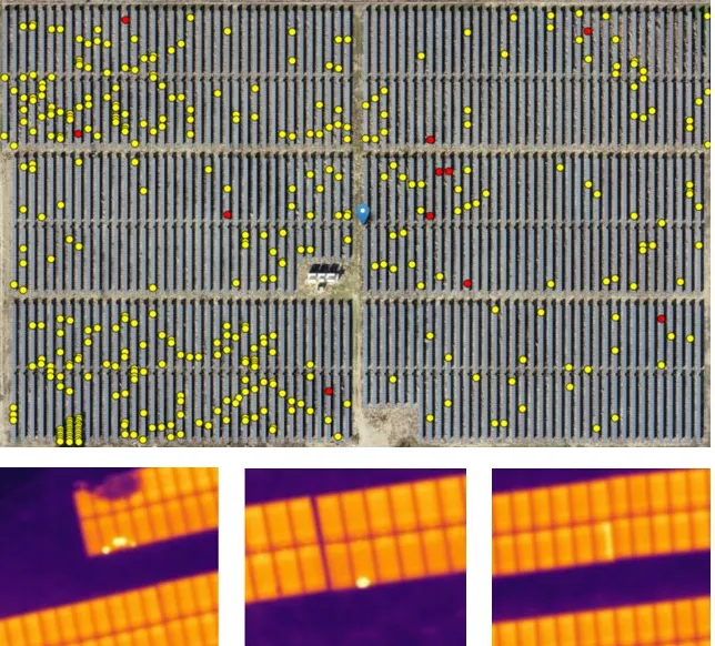
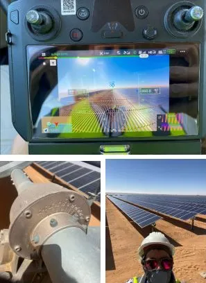
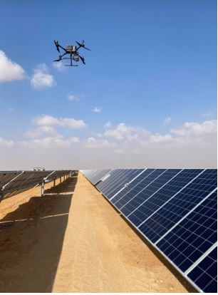
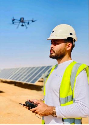
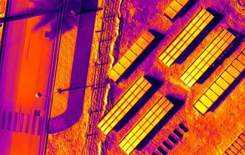
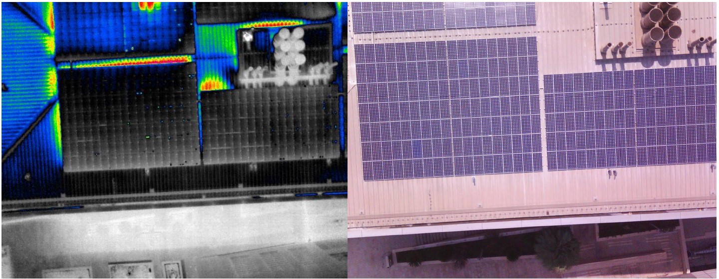
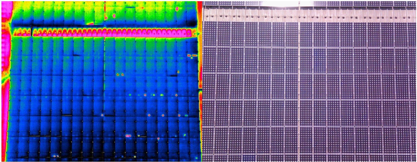
FalconViz collects aerial data using drones equipped with thermal and RGP sensors. We analyze the data utilizing AI and ML algorithms to automatically identify defects in solar cells installed on the ground or on building roof-tops.
We generate automatic inspection reports that summarize all defects and categorize them based on severity.
Electroluminescent Inspection
Electroluminescent inspection is essential for identifying solar panels that are causing yield losses. In collaboration with our partner, Sunshine Middle East, we offer a comprehensive solution that combines aerial thermography and EL inspection in a single integrated platform. This approach allows us to efficiently pinpoint problematic panels, ensuring optimal solar energy production and maximizing overall yield.
Electromagnets are a valuable tool for:
- • Quality control during new PV plant commissioning
- • Identifying panels causing losses in yield
- • Identifying the type of panel defects to accurately determine maintenance procedures and plans
Rooftop Solar Panel Installation
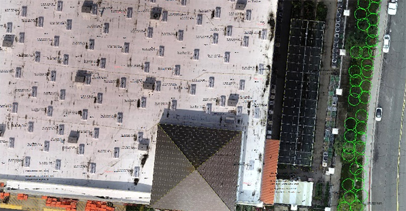
We provide 2D CAD surveys to analyze the angle and depth of shade projecting from each obstacle or unit on the roof. Solar cells must be placed under direct sunlight to provide efficient power. Our survey enables installers to place panels at the optimal location where their efficiency will not be reduced by shade.
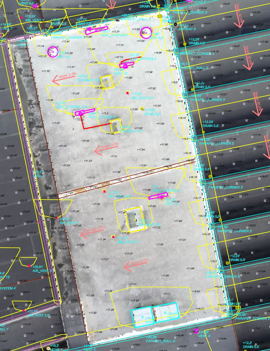
We developed a customized command tool that integrates with Autodesk Civil3D. Our tool helps create 3D polylines with the exact height projection [taken out of the point cloud] for each roof-top unit.Our tool also helps estimate the sunshade direction throughout the year. The deepest or longest shade projected is noted on the CAD drawing.
The shade length and direction of spread is also recorded. Absolute height estimations for each unit on site are also included.
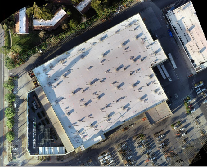
Sample of final deliverable showing a commercial building located in San Jose, USA.
A close-up of another CAD-drawn site, showing the details presented with an orthophoto underlaid.
Rooftop Inspection Deliverables
- Orthophoto (1cm resolution)
- 3D Pointcloud and Mesh
- Full CAD Topographical Survey (delivered in Civil3D)
- Spot Elevations (referenced to control point at the building's base)
- Labelled Feature Heights (e.g. walls, parapets, hvacs, etc)
- Calculated Roof Slope Grading
- Precise 3D CAD Drawing of All Roof top Features
- Calculated Shading Profiles for All Roof Features
- Shading Profiles Reflect 360 Day Sun Rotation
- Simulated Shadow Cast from Sunrise to Sunset
- Simulate Exact Shadow Cast for Chosen Time and Day
Powerline Inspection
Benefits of using drones in Transmission Tower and OHL inspection:
- Increased Safety
- Reduced work time and labor costs
- Access to hard-to-reach areas
- More accurate data
- Reduced complexity
We inspect all parts of the tower:
- Bottom crossarm on the taking offside
- Middle crossarm
- Top crossarm
- OPGW
- Marking light, warning sphere and spacer
- OPGW on the opposite side Top crossarm
- Middle crossarm
- Bottom crossarm
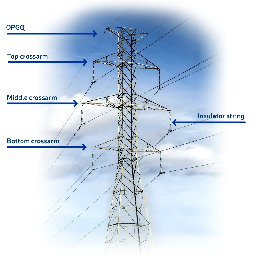
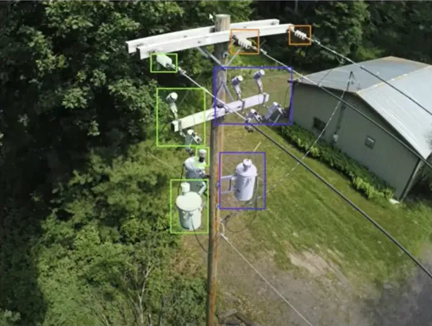
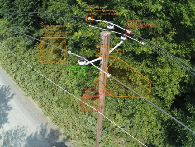
We use industry-specific customized AI solutions built by industry experts to process the drone data related to overhead transmission lines and electricity towers.
Using the AI Platform We Produce the Following For Each Tower:
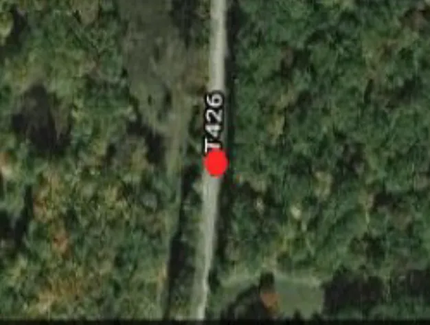
- Geographical locations of the tower
- Pole/tower type and components
- Defect List and rating
- Images with defect annotation overlay
Trusted by the Following Clients

Contact us
Get a Quote
We provide an up-front quotation on your project so you’ll know the total cost without any surprises and be in control of the cost
Get Quote
