
Blog
The Benefit in Using Drones in Topographical Surveys:
How FalconViz Has Been Transforming the Topo Survey Market in Saudi Arabia
In recent years, the field of topographical surveys has undergone a remarkable transformation, thanks to advancements in technology. One of the most significant developments in this domain has been the integration of drones into the surveying process. Drones have not only made topographical surveys more efficient but also more accurate and cost-effective. In Saudi Arabia, FalconViz has been at the forefront of this revolution, redefining the way topographical surveys are conducted in the region.
The Traditional Challenges of Topographical Surveys
Before we delve into the innovative solutions provided by FalconViz, it's important to understand the challenges that traditional topographical surveys often faced.
- Time-Consuming: Traditional topographical surveys involved sending teams of surveyors into the field for extended periods. This approach was not only time-consuming but also subjected the surveyors to challenging working conditions, especially in the desert landscapes of Saudi Arabia.
- High Costs: The labor-intensive nature of traditional surveys meant high costs for both personnel and equipment. In Saudi Arabia, where vast expanses of land often need to be surveyed, these costs could quickly escalate.
- Limited Accessibility: Certain terrains, such as remote or difficult-to-reach areas, pose accessibility challenges for survey teams. This could result in incomplete or delayed surveys.
The Rise of Drone Technology
Enter drone technology. Drones have been a game-changer in the field of topographical surveys for several reasons:
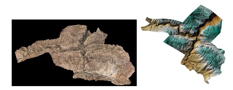
- Precision: Drones are equipped with high-resolution cameras and advanced sensors that can capture detailed topographical data with remarkable precision. This level of accuracy is crucial for various applications, including land development and infrastructure projects.
- High Costs: The labor-intensive nature of traditional surveys meant high costs for both personnel and equipment. In Saudi Arabia, where vast expanses of land often need to be surveyed, these costs could quickly escalate.
- Accessibility: Drones can access remote and challenging terrains with ease, eliminating the need for surveyors to navigate treacherous landscapes.
FalconViz: Pioneering Topo Surveys with Drones
FalconViz, a Saudi Arabian company specializing in aerial surveying and geospatial data, has harnessed the power of drone technology to revolutionize topographical surveys in the region. Here's how FalconViz has been transforming the topo survey market in Saudi Arabia:
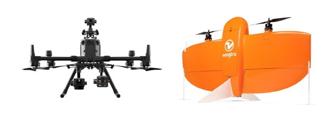
- Cutting-Edge Technology: FalconViz employs state-of-the-art drones equipped with advanced sensors and cameras capable of capturing highly detailed topographical data. These drones are operated by experienced professionals who ensure accuracy and reliability in every survey.
- Rapid Data Collection: With FalconViz's drone technology, large areas can be surveyed in a fraction of the time it would take with traditional methods. This speed of data collection is invaluable for time-sensitive projects.
- Cost-Effective Solutions: By reducing the need for extensive manpower and equipment, FalconViz offers cost-effective surveying solutions that fit a wide range of budgets. This makes topographical surveys accessible to a broader range of clients.
- Enhanced Safety: With drones handling the bulk of the survey work, the safety of surveyors is greatly improved. They are no longer required to work in challenging or hazardous environments, ensuring a safer working environment.
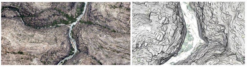
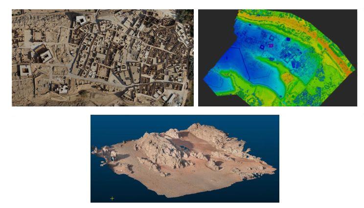
- Accurate 3D Mapping: FalconViz specializes in creating highly detailed 3D topographical maps, allowing clients to visualize and analyze the terrain with unprecedented clarity. This is invaluable for urban planning, construction, and land development projects.
- Environmental Benefits: The use of drones reduces the carbon footprint associated with traditional surveying methods, aligning with global efforts to minimize environmental impact.
The Future of Topographical Surveys in Saudi Arabia
As FalconViz continues to pioneer the use of drones in topographical surveys, the future of land surveying in Saudi Arabia looks promising. The combination of cutting-edge technology, speed, accuracy, cost-effectiveness, and safety provided by FalconViz's services has transformed the industry and opened new possibilities for development and infrastructure projects across the country.

In conclusion, the use of drones in topographical surveys, as exemplified by FalconViz in Saudi Arabia, showcases how technology can revolutionize age-old processes, making them faster, more accurate, and more accessible. With drone technology evolving rapidly, we can only expect further innovations in the field of topographical surveys, leading to better planning and development in Saudi Arabia and beyond.